Lakes inLadakh

Top 10 Beautiful Lakes In Ladakh You Must Explore

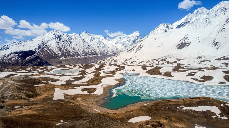
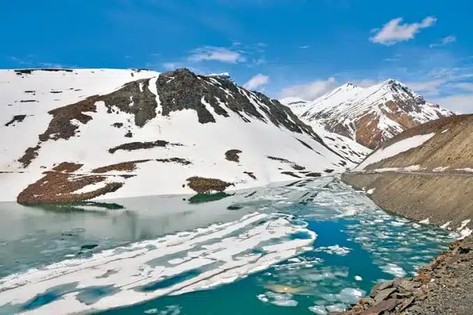
Ladakh is blessed with unique landscapes and beautiful lakes. There are many beautiful lakes in Ladakh. People from all over the world want to explore these beautiful lakes of Ladakh. These high-altitude lakes in Ladakh are known for their crystal clear water and surrounding wildlife.

“Tso” means “Lake” in Ladakhi and Tibetan language. You will read Tso multiple times in this article, so be aware that Tso simply means Lake.

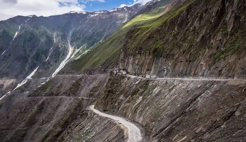
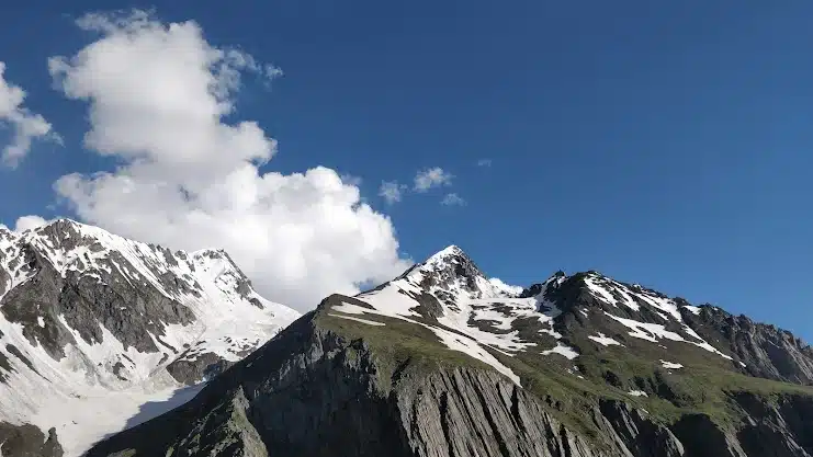
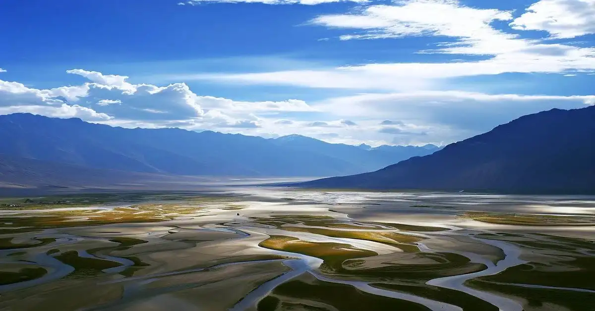
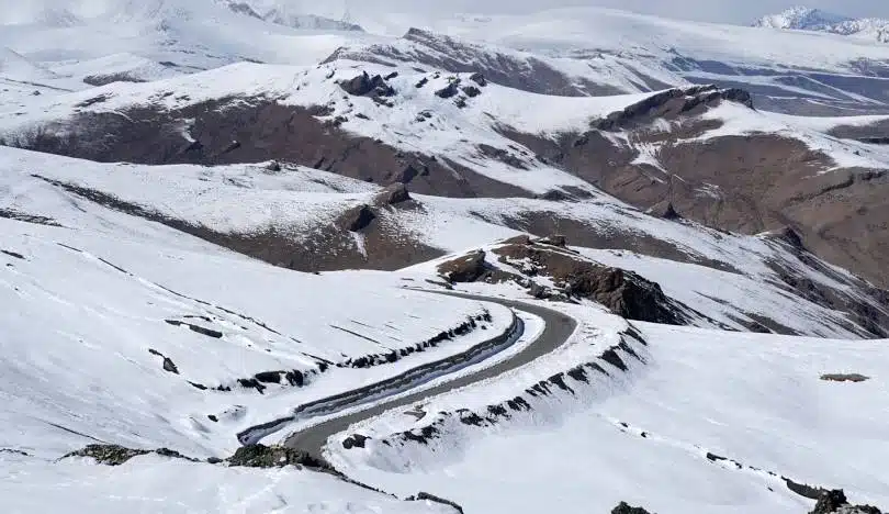
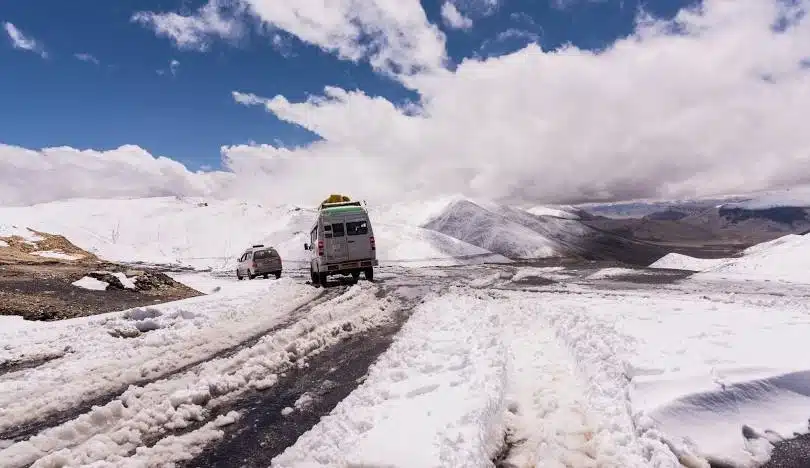
Ladakh is a region in North India situated in the Tibetan Plateau is blessed with One of the highest mountain passes, high-altitude lakes, snow-capped mountains, clear skies with no light and air pollution, rivers like Shayok, Zanskar, Suru, and Indus.

I live in Ladakh and I have visited all the destinations of Ladakh. This is why I have good knowledge of Ladakh and its beautiful destinations like the Lake of Ladakh. In this article, I will give you authentic information about the top 10 beautiful Lakes of (Ladakh) including proper routes from Leh. So let’s get started:

10. Mirpal Tso

Lakes of Ladakh, Mirpal Tso

Mirpal Tso is one of the most beautiful freshwater lakes in UT Ladakh. This lake is located in the Chumathang Valley of Ladakh. This lake is surrounded by mountains the glacier water from this mountain is the source of water for this lake. Like other lakes in Ladakh, this lake also freezes completely during the peak winter season of Ladakh.

Click the link below to check the actual location and view the photos of Mirpal Tso.

9. Yarab Tso

Lakes in Lakakh, Yarab Tso

Yarab Tso is located 15 Km from this Diskit in nubra valley. Panamik village is the nearest village to this lake. This freshwater lake is considered one of the holiest lakes of Ladakh. If you are planning to visit Yarab Tso you have to hike 20 to 30 minutes from the road. While this hike you can enjoy the surrounding mountains and flora and fauna of this region.

Click the link below to check the actual location and view the photos of Yarab Tso.

  • Best time to visit: May to September
  • Altitude/elevation: 15,750 feet (4800 m)
  • Popular routes to reach: Leh-Khardungla-Thirit-Yarab Tso
  • Distance from Leh: 133 Km
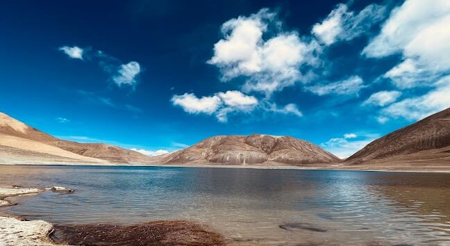
8. Chagar Tso

Chagar Tso is situated between Leh-Pangong Road, specifically in the Changthang plateau. It’s known for its stunning blue waters, surrounded by rocky mountains and sparse vegetation typical of high-altitude regions.

You can visit this lake by taking a stop while traveling to Pangong Tso from Leh. This lake is often visited by tourists for its serene beauty and the opportunity to witness the unique landscape of the Himalayan region. Chagar Tso serves as an important habitat for various species of migratory birds and other wildlife.

  • Best time to visit: May to September
  • Altitude/elevation: 14,270 feet (4,323 meters)
  • Popular routes to reach: Leh-Karu-Changla Pass-Chagar Tso
  • Distance from Leh: 135 Km

7. Spanggur Tso

Spanggur Tso is another stunning high-altitude lake of Ladakh in India. It is located in the eastern part of Ladakh, close to the Line of Actual Control (LAC) with China. Like Chagar Tso, Spanggur Tso is set amidst the majestic Himalayan mountains, offering breathtaking views.

It is known for its crystal-clear blue waters and the rugged beauty of its surroundings. The area around Spanggur Tso is a disputed land between India and China. You might read that “You can explore Spanggur Tso” on popular travel websites, but it is not true. Unfortunately, you cannot explore this Lake.

Note: Spanggur Tso is not accessible to the tourists.
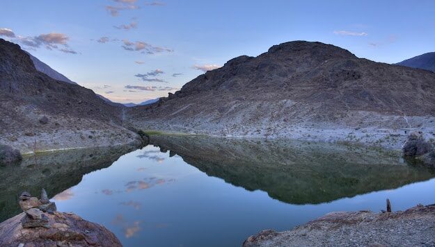
6. Chilling Tso

Chilling Tso is among the many breathtaking lakes in Ladakh. located amidst the majestic Himalayan peaks, this beautiful waterbody attracts visitors with its crystal blue waters and panoramic mountain vistas.

Accessible via winding scenic routes, the journey to Chilling Tso is as enchanting as the destination itself, it offers you an immersive experience in the raw beauty of the Ladakhi landscape. Whether you’re a nature enthusiast seeking solace or an adventurous soul craving the thrill of exploration.

  • Best time to visit: May to September
  • Altitude/elevation: 15,000 feet (4572 meters)
  • Popular routes to reach: Leh-Upshi-Nyoma-Chilling Tso
  • Distance from Leh: 210 Km

5. Yaye Tso

Yaye Tso is a beautiful high-altitude lake in Ladakh, India. It’s surrounded by breathtaking mountains, creating a picturesque and peaceful environment for visitors to enjoy. Accessing Yaye Tso involves traveling through scenic routes, allowing travelers to soak in the beauty of the Himalayas along the way.

  • Best time to visit: May to September
  • Altitude/elevation: 15,814 feet (4,820 meters)
  • Popular routes to reach: Leh-Karu-Upshi-Yaye Tso
  • Distance from Leh: 198 Km

4. Tso Kar

Tso Kar is located Ruptsu plateau in the southeastern region of Ladakh. It is a beautiful high-altitude lake of Ladakh surrounded by majestic mountains. This beautiful destination is near several other notable attractions, such as the famous Tso Moriri Lake and the beautiful villages of Thukje and Gia.

Accessible via scenic routes, Tso Kar offers visitors a unique experience amidst nature’s magnificence, with the opportunity to explore the beauty of nearby landscapes and immerse themselves in the breathtaking vistas of the Himalayas.

  • Best time to visit: May-August
  • Altitude/elevation: 14,860 feet (4,560 meters)
  • Popular routes to reach: Leh-Karu-Upshi-Tso Kar
  • Distance from Leh: 179 Km

3. Kyagar Tso

Another lake on the list is Kyagar Tso. It is a breathtaking high-altitude lake in Ladakh. This beautiful lake is surrounded by towering mountains, this serene waterbody offers visitors a beautiful and memorable experience time when you visit this Lake in Ladakh. Accessible via scenic routes, Kyagar Tso provides a mesmerizing setting for travelers to immerse themselves in the stunning beauty of the Himalayas.

  • Best time to visit: Throughout the year
  • Altitude/elevation: 15,436 feet (4,705 meters)
  • Popular routes to reach: Leh-Karu-Upshi-Kyagar Tso
  • Distance from Leh: 226 Km
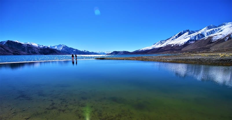
2. Pangong Tso

You might be wondering why Pangong Tso is in the top second on this list. No doubt that Pangong Lake is one of the most beautiful high-altitude lakes in Ladakh, but because of its popularity every tourist wants to visit this lake of Ladakh. It is too crowded during peak season. That is why I listed Pangong Lake as the number Second.

Pangong Tso situated in the Ladakh region of India, is a magnificent high-altitude lake renowned for its stunning beauty. Stretching across the border with China, this iconic destination captivates visitors with its crystal-clear blue waters and panoramic mountain views. Accessible via scenic routes, Pangong Tso offers a mesmerizing experience for travelers seeking to immerse themselves in the natural wonders of the Himalayas.

  • Best time to visit: Throughout the year
  • Altitude/elevation: 14,272 feet (4,350 meters)
  • Popular routes to reach: Leh-Karu-Changla Pass-Pangong Tso
  • Distance from Leh: 148 Km

1. Tso Moriri

lakes in ladakh, tso moriri

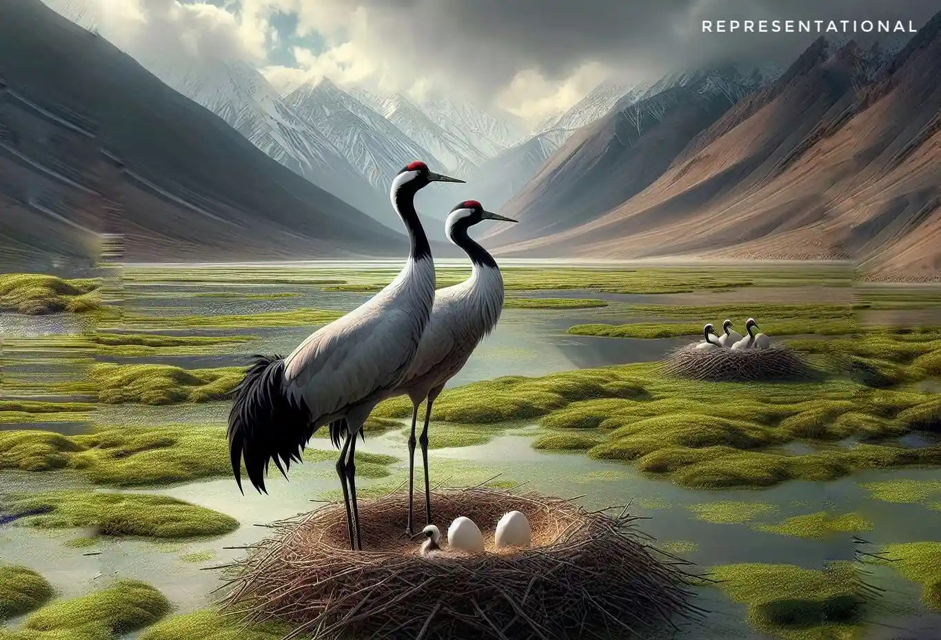
The reason behind Tso Moriri being on the top of the list is that this is one of the most beautiful lakes I have ever visited, it has a very small number of visitors as compared to Pangong Lake even during peak season. The surrounding biodiversity of this lake makes it more beautiful. You are lucky you can spot some of the rarest birds on this Lake in Ladakh.

Tso Moriri located in the Ladakh region of India, is a breathtaking high-altitude lake renowned for its serene beauty. Surrounded by snow-capped peaks, this tranquil destination offers visitors a peaceful retreat amidst the rugged landscapes of the Himalayas. Accessible via scenic routes, Tso Moriri provides a mesmerizing setting for travelers to connect with nature and soak in the majestic vistas of the surrounding mountains.

FAQ

How many lakes are there in Ladakh?

There are around 10 lakes in Ladakh and most of them are located in the upper reaches of the Himalayas.

Which is the highest lake in Ladakh?

Pangong Tso is the highest saltwater lake in the world. It is situated at an elevation of 14,272 feet (4,350 meters) above sea level.

Which is the deepest lake in Ladakh?

Pangong Tso is the deepest lake in Ladakh.

How deep is Tso Moriri lake?

The maximum depth of Tso Moriri Lake is around 350 ft (106m).

Which is the largest lake in Ladakh?

Pangong Tso is the Largest Lake of Ladakh which is around 699.3 km². The lake stretched 134 Km. About 50% of the lake is in Tibet, which is administered by China, while 40% is in Ladakh, India, and the remaining 10% is disputed and serves as a buffer zone between the two countries.

Conclusion

Ladakh is blessed with its breathtaking landscapes, water bodies, crystal clear skies, and many more. We have gone through some of the most beautiful high-altitude Lakes of Ladakh. It is very important to protect these beautiful gems of Ladakh.

In this article, I’ve tried to share my knowledge and experience of the beautiful lakes in Ladakh. Which you should know before planning to explore these beautiful lakes of Ladakh. I hope I was able to solve your problem through this blog.

If you still have any doubts or want to send feedback feel free to send it. Thank you very much for reading this article. I hope you liked it, have a nice journey.

Julley!

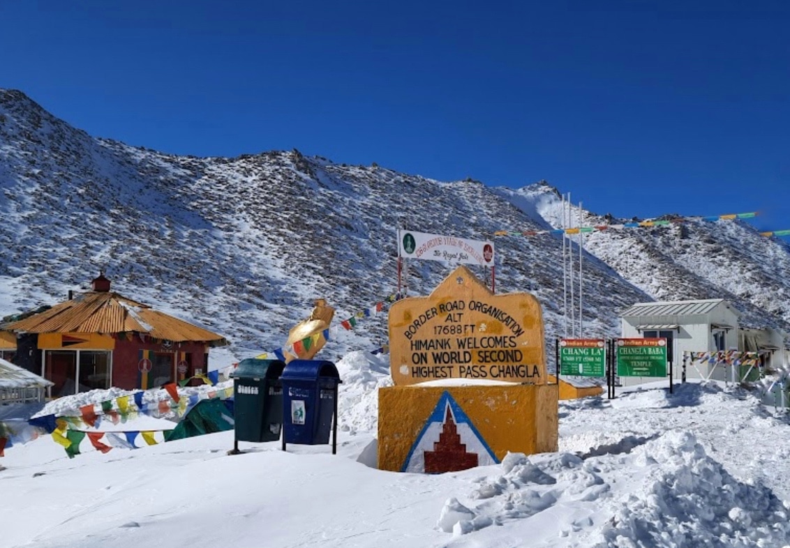
Similar experience: Changla pass in Ladakh | Complete information you need to know

Umling la pass in Ladakh | Complete information you need to know

ZOJILA PASS

Zojila Pass | Complete information you must know

Do you want to know complete information about Zojila Pass? If yes, you are at the right blog on the Internet. In this post, I’m going to share my knowledge and experience about Zojila Pass. This Pass is considered one of the deadliest passes of Ladakh, because of its deadliest accident history.

I live in Ladakh and have visited all the regions of Ladakh. I have proper knowledge about Ladakh and its destinations. I help people who want to know more about Ladakh and its destinations like Zojila Pass by providing authentic information through this blog, So let’s dive into it.

Zojila Pass Located

Zojila Pass is located in the Indian Union territory of Ladakh. This Pass is situated on the eastern side of Sonamarg of Kashmir, which is approximately 24 Km and it will take you around 40 mins of continuous drive depending upon traffic and weather conditions. It is always advised to check the weather forecast and road conditions before you visit Zojila Pass.

Zojila Pass Connects

Zojila Pass is one of the most important passes of Ladakh and it has strategic importance as well because Zojila Pass connects Ladakh with Kashmir. This Pass is considered a lifeline for Ladakh because through this pass all the necessities of Ladakh are transported via this pass.

There were several deadly road accidents in the past because of snow and ice on the roads of Zojila Pass. But still, people use this pass to access Ladakh from Kashmir and Kashmir from Ladakh.

During winter this Pass gets closed due to heavy snowfall. Because of that Ladakh gets isolated from the rest of the country, to tackle this problem indian government is building a tunnel beneath the actual pass to reduce the time and deadly accidents. Ladakh will be accessible throughout the year after the Zojila tunnel is completed.

Zojila Pass Altitude/Height

Zojila Pass is a high mountain pass in the Himalayas with an elevation of approximately 3,528 meters (11,575 ft) above sea level. Although this pass is not among the highest motorable passes in the world but still this is one of the riskiest mountain passes to drive which is why this road remains closed during winter because of heavy snowfall and poor road conditions.

Zojila Pass Oxygen Level

The elevation of Zojila Pass is approximately 3529 meters (11,575 ft) above sea level. The oxygen level of this Pass is around 50% (quantity of oxygen molecules per breath). People visiting this Pass without proper acclimatization may suffer altitude sickness, also known as Acute Mountain Sickness (AMS), because of less oxygen concentration in the air and high altitude.

Zojila Pass Temperature

The average temperature at Zojila Pass varies depending on the season. In winter, temperatures can drop up to -30; in summer, they can reach up to 20°C (68°F).

Zojila Pass receives heavy snowfalls during winters and during summertimes, the water from melting snow and natural springs remains on the roadsides of this pass.

Sometimes it freezes and makes the road too slippery, which makes this pass one of the riskiest roads to drive because if the driver makes a little mistake the vehicle will go into the deep trench on the side of Zozila Pass road.

Zojila Pass famous for

ZOJILA PASS

Zojila Pass is famous for its stunning landscape and breathtaking view from the road. The roads of this pass is very adventurous for bikers, bikers from across the country use this bus to reach Ladakh from Kashmir. Riding on the roads of this pass is very adventurous, riders want to ride on this road to feel that adrenaline rush.

How to reach Zojila Pass

Sometimes reaching this pass can be challenging because of bad weather and poor road conditions, so it is always advised to check weather conditions before visiting. If you’re planning to visit Zojila Pass, There are two routes from which you can reach this pass, which are as follows:

Best time to visit Zojila Pass

Although Border Road Organization (BRO) tries to keep the road of Zojila pass open throughout the year. But still the road gets close due to heavy snowfall during winters. So the best time to visit Zojila pass is during summer time (May to October) when the temperature and weather are ideal to visit this pass

Things to carry visiting

If you are visiting one of the highest motorable and riskiest passes in the world you should have proper knowledge about what things should be carried in your backpack while visiting Zozila Pass.

Here is a list of essential items to carry in your backpack while visiting Zozila Pass:

  • Warm clothing and layers
  • Waterproof and windproof outerwear
  • Sturdy footwear with good traction
  • Hat, gloves, and scarf for additional warmth
  • Sunglasses and sunscreen for protection against the sun
  • Water bottle and snacks for hydration and energy
  • First aid kit with basic medical supplies
  • Personal medications, if needed
  • Map, compass, or GPS device for navigation
  • Mobile phone and power bank for communication and emergencies

FAQ

Is Zojila Pass worth visiting?

Yes, Zojila Pass is worth visiting. It is one of the highest and strategically important passes of Ladakh, which is why you should visit this pass.

Is Zojila Pass safe?

Yes, Zojila Pass is safe. But you should be very careful because this pass is considered one of the riskiest passes of Ladakh.

Which pass is near Sonmarg?

Zojila Pass is the nearest pass from Sonmarg.

Which river is near Zojila Pass?

Drass River is the nearest river to Zojila Pass

Why is Zojila Pass called zero point?

Zero-point is a location where the snow never melts. Even during summertime, the snow at Zeropoint remains frozen.

Conclusion

In this article, I have tried to share my experience and knowledge about Zojila Pass. Which you should know before visiting this beautiful mountain pass on the border of Kashmir and Ladakh. I hope I was able to answer the questions in your mind.

If you still have any doubts or want to share your valuable feedback feel free to send it. Thank you so much for reading this article. I hope you liked it, have a nice day.

Jullay!

Similar experience: Fotu la Pass | Complete information you must know

Best time to visit Ladakh | Reach Ladakh by bike, car, or any | A complete guide

Wari La Pass, Passes in Ladakh

Wari la Pass | Complete information you need to know

Are you looking to know more about Wari la Pass of Ladakh and searching on the internet for authentic information about this pass In Ladakh? Biker from across the globe wants to ride on the beautiful roads of Ladakh.

I live in Ladakh and I have visited all the regions of Ladakh. I guide travelers, students, and other people who want to learn more about Ladakh and its destination by providing authentic information.

Wari la Pass Located

Wari la Pass is Located in the Indian Union territory of Ladakh. It is one of the most beautiful Passes in Ladakh. Which is approximately 73 Km from Leh City. Warila Pass is considered one of the highest motorable passes in the world.

If you are planning to visit this pass, you can start your journey early in the morning from Leh Market. That will take you around 1 hrs 30 minutes depending upon traffic and weather conditions.

Wari la Pass Connects

Wari La Pass  connects Nubra Valley

The main purpose of these high mountain passes is to connect one place of a region to another. Wari la Pass connects Leh to Nubra Valley. It is an alternative way to reach Nubra Valley. Usually, the people of Ladakh use the Khardungla Pass to reach Nubra Valley.

This route is longer as compared to the Khardungla Pass. Still, Warila Pass is strategically very important for the Indian army because the Indian army can access the eastern part of Nubra Valley (Rangdu and Agham) faster compared to reaching via Khardungla Pass.

Wari la Pass Altitude/Height

Ladakh has some of the highest motorable passes in the world. Wari la Pass is considered one of the highest motorable passes in the world, this pass is listed 4th highest motorable pass in the world.

The altitude/Height of Wari la Pass is 5,312 meters (17,427 feet) above sea level, which is why riders from across the globe want to ride on the road of this pass.

Wari la Pass Oxygen Level

As the elevation of the place goes up the oxygen level goes down, the elevation of Warila Pass is 5,312 meters (17,427 feet) above sea level. That is why the oxygen level of Wari la Pass is around 50% (quantity of oxygen molecules per breath).

The concentration of oxygen at Wari la Pass is dangerous if you’re not properly acclimatized before visiting this place. Staying more than 15 to 20 minutes can increase the chances of Acute Mountain Sickness (AMS).

Wari la Pass Temperature

Wari la Pass is situated on one of the highest passes of Ladakh, which is why the temperature of Wari la Pass is lower as compared to other places in Ladakh. During summer the temperature of Wari La Pass goes up to 10°C to 15°C.

But during winters the temperature can go below -25°C. When there is heavy snowfall this Warila Pass gets closed because it can be dangerous if you ride or drive on the snowy roads.

Wari la Pass famous for

Wari La Pass Landscape

Wari La Pass is famous for its breathtaking view from the road and the road is thrilling to drive or ride. It is a newly opened pass which is why most people are not aware of its stunning beauty of landscape, wildlife around the road, and snowcapped mountains around the roads. This pass is a paradise for riders because of its challenging road, riders enjoy this pass a lot.

How to reach Wari la Pass

If you’re planning to visit Wari la Pass and want to know how to reach this Pass. There are two routes from which you can reach Warila Pass.

  1. Leh-karu-Sakti-Wari La Pass
  2. Manali-Jispa-Rumtse-Upshi-Karu-Sakti-Wari La Pass

If you are planning to reach this pass from Leh, you can do that by starting your journey from Leh. Which is approximately 74 Km from Leh market, It will take you around 1 hr 45 min of continuous drive.

Another route to reach Wari La Pass is from Manali-Jispa-Rumtse-Upshi-Karu-Sakti-Wari La Pass by following National Highway 3 (NH3). Starting your journey from Manali to Jispamto Rimste and Karu. Once you reach Karu take a right toward Skati by following Leh Pangong Road. Once you reach Sakti village take a left and follow until you reach your destination.

Best time to visit Wari la Pass

The best time to visit Wari la Pass is during the summer months. It is recommended to visit between May and September. The weather during this time is pleasant and the pass is usually open for travel.

It is important to note that the pass may be closed during the winter months due to heavy snowfall, so it is advised to check the road conditions before planning your visit.

Things to carry visiting Wari la Pass

Whenever you are planning to visit these high mountain passes in Ladakh. You should have some idea about what things to carry when visiting Wari La Pass.

Here is a checklist of things to carry when visiting Warila Pass:

  • Warm clothing and layers
  • Sturdy hiking boots
  • Sunscreen and sunglasses
  • Hat or cap
  • Water bottle and hydration pack
  • Snacks and energy bars
  • First aid kit
  • GPS device or map
  • Camera and extra batteries
  • Power banks
  • Cash and
  • Identification document

FAQ

Which is the highest pass in Ladakh?

Umling La Pass in Ladakh is world higest moterable Pass.

What is the name of the pass from Leh to Pangong?

Chang La Pass is the pass from Leh to Pangong, this pass is known as the gateway to Pangong and Changthang region of Ladakh.

What is the pass from Leh to Kargil?

Fotu La Pass connects Leh to Kargil.

Which pass connects Leh to Kashmir?

Zozila Pass connects Leh to Kashmir.

Conclusion

Ladakh is blessed with breathtaking landscapes like high mountain passes like Wari La Pass. In this article, I have tried to share my experience and knowledge of this passes. I am hoping that I was able to answer your questions.

If you still have any questions regarding Wari La Pass or want to share your valuable feedback feel free to send it. Thank you so much for reading, Jullay!

Similar experiences: How to reach Pangong Lake from Manali

Fotu la Pass, Passes in Ladakh

Fotu la Pass | Complete information you must know

Are you looking to know about Fotu la Pass in Ladakh? You are on the right to blog on the internet. Also known as “The Land of High Passes” because there are many high mountain passes in Ladakh. In this blog, I share my experience and information about Ladakh and its destination.

Ladakh is known for its beautiful topography, crystal clear skies, mesmerizing rivers and Lakes, high-altitude wildlife, art, and culture. So many travelers from all over the world want to visit Ladakh to experience the amazing things you can find in Ladakh.

I live in Ladakh and I have visited every single region of Ladakh. In this article, I will share the complete information you need to know before visiting this place. So, Let’s dive into it.

Fotu la Pass Located

Fotu la Pass is one of the most fascinating high Mountain passes in Ladakh. It is considered one of the most beautiful Passes of Ladakh. It is located on the Srinagar-Ladakh highway (NH1).

Fotu la Pass is situated eastern side of Kargil City, which is approximately 89 kilometers and it will take you around 2 hours of continuous drive. Leh is approximately 129 Km from here.

You can click the attached map for more details.

Fotu la Pass connects

Fotu la Pass is considered one of the most important mountain passes in Ladakh because it connects Srinagar to Leh. It is also known as the lifeline of Ladakh because all of the necessary goods are imported from outside Ladakh. Ladakh does not have enough fertile land to cultivate food.

Strategically Fotu la Pass is also important for the Indian army because during summertime. The Indian army used this pass to store food, ammunition, and other military equipment for the soldiers posted in border areas.

Fotu la Pass Altitude/Height

You might be thinking what is the Altitude/height of Fotu la Pass? It is not among the highest Passes of Ladakh. But it is the highest pass between Srinagar to Leh highway. The elevation of Fotu la Pass is 4,108 meters (13,478 feet) above sea level.

Fotu la Pass Oxygen Level

Usually, the level in these high passes is low as compared to the plan areas. As the elevation of a place goes up the oxygen level in the air goes down.

The level of oxygen at Fotu la Pass is approximately 60% per breath (quantity of oxygen molecules per breath). Which can be dangerous if you do not properly acclimatize before visiting this Pass.

Fotu la Pass Temperature

Temperatures in the high passes are low because it is situated in high-altitude areas. If you are wondering what is the temperature of Fotu la Pass? The elevation of Fotu La Pass is 4,108 meters (13,478 feet) above sea level.

The temperature of Fotu la Pass during summer reaches up to 10°C to 15°C. During winter the temperature of Fotu La Pass can go up to -30°C.

Fotu la Pass famous for

Fotu la Pass view

Ladakh is known for its breathtaking landscape, beautiful roads, and high mountain passes, Fotu la Pass is one of them. It is famous for its stunning mountains of the Zanskar range, you will be mesmerized if you visit there and have a look at the surroundings.

You can get one of the best photos for your collection with beautiful backgrounds. Travelers take a stop to take pictures and feel that adrenaline rush at the Fotu la Pass.

How to reach Fotu la Pass

Fotu la Pass

The main reason to build roads in these Passes is to connect one region of a place to another. Fotu la Pass remains open throughout the year. If there is no heavy snowfall on the pass. There are two routes from which you can reach Fotu la Pass.

  1. Srinagar-Zozila Pass-Kargil-Fotu la Pass
  2. Leh-Nimmoo-Lamayuru-Fotu la Pass

If you want to reach Fotu la Pass from Srinagar, it is approximately 290 kilometers, which is 7 hrs of continuous journey depending upon weather and traffic conditions.

You can reach Fotu la Pass from Leh City as well. If you want to reach Fotu la Pass from Leh, It is approximately 123 kilometers, which will take 2 hrs and 50 min of continuous driving depending upon weather and traffic conditions.

Best time to visit Fotu la Pass

The best time to visit Fotu la Pass is during the summer (May to October), When the temperature is ideal to visit this pass. During these months the temperature ranges between 10°C to 15°C.

It is a good time for you to visit this pass because you can do many things like photography and videography, and you can enjoy the surrounding view from the top.

Things to carry visiting Fotula Pass

It is very important to know what things you should carry when you are visiting some of the mountain passes of Ladakh. Fotu la Pass is also a high mountain pass, where things can go dangerous anytime. That is why you should have some important things in your backpack.

Here are the following things to carry while visiting Fotu la Pass:

  • First aid kit
  • Proper clothing
  • Power banks
  • Cash
  • Pocket knife
  • Sunscreen
  • Sunglasses
  • Water bottle
  • Snacks like dry fruits

FAQ

What is the highest pass in Leh Ladakh?

Umling Pass is the world’s highest motorable pass

Which pass is called the gateway of Ladakh?

Zozila Pass is known as the gateway of Ladakh.

Which pass is near Pangong Lake?

Rezangla Pass and Changla Pass are the nearest Passes to Pangong Lake

Conclusion

In this article, I have tried to give you authentic information about Fotu la Pass. It is important to know if you have plans to visit this Pass. If you’re planning to visit this Pass you can consider the above information that is provided for you.

I hope I was able to answer your questions about Fotu la Pass. If you still have any questions or want to give feedback feel free to send it. Thanks a lot for reading this blog, have a nice day, jullay!

Similar Experiences: Khardung La Pass Ladakh: Details Information you should know

Pensi la pass

Pensi La Pass | Complete information you must know

Ladakh is known for its stunning landscape and high passes. Pensi La Pass is one of the important Passes in Ladakh. Are you looking to learn more about the passes of Ladakh? You’re in the right place on the Internet to learn authentic information about Ladakh and its destination.

Ladakh is blessed with incredible landscapes, high mountain passes, glaciers, crystal clear skies, clean water bodies, and many more. This is why people from all over the world want to learn and explore more Ladakh. If you are one of them I can provide you with the best information about the destinations of Ladakh like Pensi La Pass.

I live in Ladakh and have visited every region of Ladakh. I can provide you with the best and most authentic information that you need to know about Pensi La Pass in Ladakh. It doesn’t matter if you are a student or a traveler who wants to learn more about Pensi La Pass, let us dive into it.

Pensi La Pass Located

Pensi La Pass is located in the Indian union territory of Ladakh. It is situated approximately 155 km from Kargil city, which will take you around 3 hrs 50 min of continuous drive. If you want to reach Pensi La Pass from Padum, it is approximately 79 Km and it will take you around 1 hour 50 min of continuous drive.

Click the Google Maps to learn more about the Pensi La Pass Location.

Pensi La Pass connects

The main reason for these high mountain passes is to connect one region to another region of a place. Pensi La Pass is one of the most important passes in Ladakh. Pensi La Pass is often called the gateway to Zanskar because connects Suru Valley Kargil to the Zanskar region of Ladakh. Due to heavy snowfall on this Pass, it remained closed during winter until the road got clear.

Pensi La Pass Altitude/Height

Ladakh has some of the highest motorable passes in the world. Pensi La Pass is one of them. It is considered one of the most beautiful passes in Ladakh because on its eastern side the world-famous glaciers Drang Drung Glacier is situated. Which is approximately 6 Km (8 Minutes) from it.

The elevation/altitude of this Pensi La Pass is 4,400 meters (14,436 feet) above sea level.

Pensi La Pass Oxygen Level

We know that when the elevation of a place is high it is more likely to have less concentration of Oxygen in the air. This is why Pensi La Pass also has less concentration of oxygen in the air.

The Oxygen level of Pensi La Pass is approximately 60% (quantity of oxygen molecules per breath). Which is dangerous if you are not acclimated properly. Staying for long periods in high passes is not recommended because it may increase the chances of Acute mountain sickness (AMS).

Pensi La Pass Temperature

The temperature in high passes is usually lower as compared to plans. As we know the elevation of Pensi La Pass is 4,400 meters (14,436 feet) above sea level. That is why the temperature of Pensi La Pass during winter can go up to -30°C. If we talk about the temperature of Pensi La Pass during summer, it can go up to 15 to 20°C.

Why is Pensi La Pass famous for

Pensi la pass twin lake

Pensi La is one of the important passes in Ladakh. Pensi La Pass is famous for its breathtaking view from the top and beautiful twin lake. You can find snow almost every time you visit the top of Pensi La Pass. People get beautiful selfies from this place. It is also the gateway to the Zanskar region of Ladakh.

How to reach Pensi La Pass

Pensi La Pass is one of the beautiful high mountain passes in Ladakh. There are two routes from which you can reach this beautiful pass.

  • Sirnagar/Leh-Kagril-Panikhar-Pensi La Pass
  • Manali-Darcha-Shinku La Pass-Padum-Pensi La Pass

If you want to reach Pensi La Pass from Srinagar/Leh, first you have to reach Kargil and start your journey towards Panikhar (65 Km), and after that move towards Pensi La Pass (89 Km). In total, you have to drive for 3 hrs 50 mins.

Best time to visit Pensi La Pass

Pensi la pass

If you’re wondering what time will be the best to visit Pensi La Pass it is during the summer (May to October). During summer the temperature and the weather are optimal for visiting this pass, when the temperature ranges between 15°C to 20°C.

The ideal time to visit Pensi La Pass is during the summer. This time is perfect for a tourist to enjoy the beautiful view from Pensi La Top, where you can enjoy the glacial wind, snowcapped mountains, flora and fauna around it.

Things to carry visiting Pensi La Pass

If you are planning to visit any passes in Ladakh. It is very important to know things to carry when visiting Pensi La Pass. Because it is a high-altitude mountain pass you should be very careful about what things you should carry.

These are the following important things to carry when you visit Pensi La Pass.

  1. Proper Permit
  2. First Aid Kit
  3. Proper clothing
  4. Power Bank
  5. Water bottle
  6. Sunglasses
  7. Sunscreen
  8. Cash

FAQ

In which district is Drang-Drung Glacier?

Drang-Drung Glacier is located in the Kargil district of UT Ladakh.

Which pass is known as the gateway to Zanskar?

Pensi La Pass is known as the gateway to Zanskar.

Which river flows through Zanskar Valley?

Tsarap River flows through Zanskar Valley.

Which river is between Ladakh and Zanskar Range?

Indus River is between Ladakh and Zanskar Range.

Conclusion

In this article, I have tried to share my experience and knowledge about Pensi La Pass. I have tried to answer your questions. If you are planning to visit Pensi La Pass you can consider my above information.

I hope I was able to clear your doubts about Pensi La Pass. If you still have any questions or feedback feel free to send it. Thank you so much for reading. Have a nice day, Julley!

Similar Experiences: Khardung La Pass Ladakh: Details Information you should know

rezang la pass, Passes in Ladakh

Rezang La Pass | Complete information you must know

There are many “LA” meaning “Passes” in Ladakh, and Rezang La Pass is one of them. Are you looking to learn more about the passes in Ladakh? If ‘yes’ you are on the right blog on the Internet. Ladakh is known for its breathtaking landscape, crystal clear skies, high mountain passes, and clean water bodies like Pangong Tso, Tso Moriri Lake, Indus River, and more.

I live in Ladakh and have been to every region of Ladakh, which is why I have good knowledge of the destinations of Ladakh. I have recently visited Rezang La Pass, I can provide you best knowledge about this Pass.

It doesn’t matter if you’re a student, tourist, or any normal person who is searching on the Internet about Rezang La Pass, So let’s dive into it.

Rezang La Pass Located

Rezang La Pass is Located in the Indian Union territory of Ladakh. It is situated at approximately 41 Km from Pangong Lake. Rezang La Pass is more famous for the Sino-Indian War of 1962. The war was fought between India and China.

You can click the map attached below to learn more.

Rezang La Pass connects

Rezang La Pass is one of the passes which is at the border between India and China. This pass was the battlefield between India and China. China wanted to capture the Chusul Valley of Ladakh. However, the Indian army was able to stop Chinese forces in this Pass.

Rezang La Pass connects Chusul Valley, the Indian-administered Ladakh to the Chinese-administered Spanggur Lake basin which is also claimed by India.

Rezang La Pass Altitude/Height

Ladakh has an average elevation of 3000 meters above sea level. Rezang La Pass altitude/height is 17,057 ft (5,199 m) above sea level. This makes Rezang La Pass one of the world’s highest battlefields where two armies ever fought.

Rezang La Pass Oxygen Level

Ladakh has the unique feature of a low concentration of oxygen in the atmosphere. This is why you may feel breathless while visiting these high mountain passes of Ladakh. You might be thinking what is the level of oxygen in the air of Rezang La Pass?

The oxygen level of Rezang La Pass is around 50%, which is extremely low. which is why doctors do not suggest staying for a long duration on the top of the Passes of Ladakh. Staying for a longer duration may increase the chances of Acute mountain sickness.

Rezang La Pass Temperature

If the elevation of a place goes up the temperature goes down. As we know the elevation of Rezang La Pass is 17,057 ft (5,199 m) above sea level. This is why the temperature of this place is very low compared to the other places in Ladakh.

The average temperature of Rezang La Pass during summer reaches around 14°C. During winter the temperature reaches -30°C which is extremely cold.

Rezang La Pass famous for?

rezang la memorial

Rezang La Pass is famous for the war between Sino-Indian War in 1962. Rezang La war memorial was built on 5 August 1963 to tribute to the soldiers of Charlie Company of the 13 Battalion of Kumaon Regiment. Who fought bravely against China soldiers in November 1962. Out of 120 soldiers of Charlie Company of 13 Battalion of Kumaon Regiment, 114 soldiers were martyrs during this war. Chinese Army has lost 1000 soldiers.

Rezangla War Memorial is a major tourist attraction near Rezang La Pass. People from across India want to visit this place for the war that took place between India and China.

You can click the attached Map below to view the photos.

How to reach Rezang La Pass

If you are looking to visit Rezang La Pass, you can visit this place from Leh. You can follow the Leh-Tangtse-Chusul-Rezang La route. Which is approximately 210 Km from Leh market, which will take you around 4 hrs 50 mins of continuous drive. Another route to reach Rezang La Pass from Leh is Leh-Chumatnag-Chusul-Rezang La Pass route, which is approximately 243 Km from and will take you around 5 hrs of continuous driving.

You can reach Rezang La from Manali as well. The distance from Manali to Rezangla is approximately 503 Km. It will take you about 15 hrs of continuous drive. If you are reaching Rezang La from Manali, it is highly recommended to take an overnight stay at Jispa because it will be very long and tough to drive 15 hrs continuously.

Best time to visit Rezang La Pass

If you are looking to learn the best time to visit Rezang La Pass, The best time to visit Rezang La Pass is during the summer (May to September). Because it is the ideal time when there is no chance of road blockage due to snowfall.

Visiting the actual pass is not allowed for civilians because of security reasons but you can visit Rezangla War Memorial which is the main tourist attraction. it is recommended to carry proper permits and ID cards and check UT Administration guidelines before visiting this beautiful Pass of Ladakh.

Things to carry visiting Rezang La Pass

No matter where you go, it is very essential to know what are the important things to carry when you are visiting any place in Ladakh. As Rezang La Pass is located in the India-China border you have to be very careful about things to carry.

These are the following important things to carry when you visit Rezang La Pass.

  1. Proper Permit
  2. ID card
  3. First Aid Kit
  4. Proper clothing
  5. Power Bank
  6. Water bottle
  7. Sunglasses
  8. Sunscreen
  9. Cash
  10. Pocket Knife

FAQ

How many Chinese died in Rezang La?

More than 1000 Chinese soldiers died in the Rezangla war in November 1962.

Which area India lost in 1962 war?

India lost Aksai Chin in 1962 war agenst China.

How far is Rezang La War Memorial from Pangong Lake?

Rezang La War Memorial 41 Km from Merak, Pangong Lake.

Conclusion

In this article, I have tried to share my experience with Rezang La Pass. I have tried to answer questions in your head. If you are planning to visit this pass consider the above details I have shared.

I hope I was able to clear your doubts about Rezang La Pass. If you still have any questions or feedback about the same feel free to send. Thank you so much for reading. Have a nice day, Julley!

Similar Experiences: Rezang-la Full Moon Marathon 2023 | Moonlight Marathon Ladakh

Ladakh’s Full Moon Marathon 2023 | Rezang-la Full Moon Marathon Results

Lachulung La Pass, Passes in Ladakh

Lachulung La Pass | Complete information you must know

Are you looking to know more about the passes of Ladakh? Lachulung La Pass is one of them. Ladakh is known for its breathtaking landscape, art, culture, and the high passes. If you’re searching on the Internet to know more about Lachulung La Pass you are on the right blog.

I have visited all the regions of Ladakh, that’s why I have good knowledge of destinations like Lachulung La Pass. I can guide you by providing ohh authentic information about Ladakh and its destinations

It doesn’t matter whether you are you student tourist or in normal person searching on the Internet to know more about destinations like Lachulung La Pass in Ladakh.

Lachulung La Pass Located

Lachulung La Pass is located in the Indian Union territory of Ladakh. It is situated on the Leh-Manali Highway (NH3). Lachulung La Pass is known for its spectacular view from the top.

It is approximately 196 kilometres from Leh which will take you around 4 hr 30 mins depending upon traffic and weather conditions. The distance between Lachulung La Pass to Manali is approximately 232 kilometers.

You can click the map attached below to learn more.

Lachulung La Pass connects

Ladakh is often called “the land of high passes” because if you want to reach different regions of Ladakh or any place in Ladakh you have to cross “La” meaning the mountain pass.

Border Road Organization (BRO plays a vital role in building smooth roads in these high passes of Ladakh. So that the different regions of Ladakh can be accessible from across the country. Lachulung La Pass is one of them because it connects Leh to Manali.

Lachulung La Pass Altitude/Height

It is considered one of the highest motorable passes in Ladakh because of Lachulung La Pass’s Altitude/Height of 5,059 m (16,598 ft) above sea level. It is not recommended to visit Lachulung La Pass without any proper acclimatization.

Lachulung La Pass Oxygen Level

One of the unique features of these high mountain passes is less concentration of oxygen in the atmosphere. This is why you might be thinking what is the oxygen level of Lachulung La Pass?

The level of oxygen in Lachulung La Pass is around 50%, which is extremely low. This is why it is not recommended to stay at Lachulung La Pass for a long period.

Lachulung La Pass Temperature

Another unique feature of these high mountain passes is the low temperature as compared to the lower regions of Ladakh. Lachulung La Pass’s Temperature during summer (May to Augest) is around 15°C to 16°C. The temperature of Lachulung La Pass during winter is -30°C.

Lachulung La Pass famous for?

Lachulung La Pass

Unlike the other Passes of the Ladakh, Lachulung La Pass famous is for its beautiful surrounding mountains and desert sunset.

Bikers from across the country visit this place for breathtaking photos and memories. Buddhists of Ladakh make a stop here to tie prayer flags on the pass for safety and luck.

How to reach Lachulung La Pass

You can reach Lachulung La Pass from two sides, one is from Leh another is from Manali. If you’re planning to visit this Pass you can visit from both sides. If you want to visit from Leh it is approximately 196 kilometres from Leh, which will take you around 4 hrs and 30 mins depending upon the traffic and weather conditions.

If you want to reach Lachulung La Pass from Manali, it is approximately 232 kilometers. It will take you approximately 6 hrs of continuous driving depending upon the traffic and weather conditions.

Best time to visit Lachulung La Pass

If you’re looking to know the best time to visit Lachulung La Pass it is during summer. Because the road and weather conditions are ideal for visiting this Pass. The best time to visit Lachulung La Pass is May to October. It is always recommended to check the weather forecast and UT Administration guidelines before visiting this beautiful Pass of Ladakh.

Things to carry visiting Lachulung La Pass

Lachulung La Pass

It is very important to know what things you should carry before visiting this pass. If you are visiting some of the highest passes in Ladakh. I have listed some of the most important things to carry while visiting Lachulung La Pass.

Which are as follows:

  1. Proper clothing
  2. First aid kit
  3. Water bottle
  4. Power bank
  5. Cash
  6. Sunscreen
  7. Sunglasses
  8. Pocket knife

FAQ

Why is Changla Pass famous?

Changla Pass is famous because it is the gateway to the prestige high-altitude Pangong Lake.

Which pass is famous in Leh Ladakh?

Umling La Pass and Khardung La Pass are the famous Passes of Ladakh.

Which pass is near Pangong Lake?

Rezang La Pass is near Pangong Lake.

Which pass is between Nubra and Leh?

Khardung La Pass is between Nubra and Leh.

Conclusion

In this article, I have shared my experience and knowledge about one of the famous Pass of Ladakh. I have tried to solve your doubts, if you planning to visit Lachulung La Pass in Ladakh.

I hope I was able to clear your doubts about Lachulung La Pass. If you still have any doubts or feedback feel free to send. Thank you so much for reading this blog. Have a nice day, Julley!

Similar Experiences: Khardung La Pass Ladakh: Details Information you should know

Taglang La Pass, Passes in Ladakh

Taglang La Pass | Complete information you must know

Ladakh is known for its stunning landscape and breathtaking high passes that’s why it’s called the “land of high passes”, Taglang La Pass is one of them. If you’re looking to know more about Tanglang La Pass, you are on the right blog on the Internet.

I live in Ladakh and explored all regions of Ladakh and the Passes of Ladakh. I will guide you by providing the best and most authentic information about Ladakh.

If you are a traveler, student, or any normal person who wants to know more about Ladakh’s art, culture, and its tourist destinations like Taglang La Pass, I am here to provide you with authentic information, so don’t worry Let us began the journey of Tanglang La Pass.

Taglang La Pass Located

Taglang La Pass is located in the Indian Union territory of Ladakh. It is situated on the Leh-Manali Highway (NH3). It is approximately 108 Km from Leh City, which will take you around 2 hr and 30 minutes of continuous ride depending upon traffic. The distance from Taglang La to Manali is approximately 365 Km.

You can check on the following attached Map:

Taglang La Pass connects

The main purpose of building motorable roads on the high passes is to connect one region to another region of a place. So, that people and the army can access the region easily and swiftly. Taglang La Pass connects Leh city to Manali. It remains closed during winter because of heavy snowfall, but the Border Road Organization (BRO tries to keep the pass open.

Taglang La Pass Altitude/Height

You may have read that Taglang La Pass is the second highest motorable pass in the world Khardungla Pass on other travel websites but it’s not true. The altitude on the signboard of Taglang La Pass has some error. The actual altitude of Taglang La Pass is 5,328 meters (17,480 ft) above sea level.

Taglang La Pass Oxygen Level

Like all the other passes of Ladakh, Taglang La Pass also has a very low concentration of oxygen in the air. As we know the elevation of Taglang La Pass is 5,328 meters (17,480 ft) above sea level. This is why Taglang La Pass has a very low concentration of oxygen in the air. The Oxygen Level at Taglang La Pass is 0.51 atm which is 51%.

Taglang La Pass Temperature

Ladakh is a cold desert in India because of its high elevation and less precipitation. Taglang La Pass is situated at an elevation of 5328 meters from sea level which is why the temperature is lower as compared to areas with a lower elevation.

During the winters the temperature of Taglang La Pass goes -38°C and during summer the temperature ranges between 10°C to 25°C. Which is considered the ideal time to visit Taglang La Pass.

Taglang La Pass famous for?

Taglang La Pass famous for

Taglang La Pass is famous for its stunning landscape and breathtaking view from the top. Bikers coming from Manali stop there to take pictures. It is considered one of the highest motorable passes in Ladakh which is why tourists want to visit here for the adrenaline rush. If you want to visit Leh from Manali it will be on your way.

How to reach Taglang La Pass

Taglang La Pass is considered the gateway of Leh. If you want to visit Taglang La Pass you can reach from Manali and Leh City. To reach Taglang La Pass from Manali it is approximately 365 kilometres from Manali. You have to start your journey towards Leh by following Leh Manali Highway (NH3) early in the morning to see its beautiful view in the evening.

If you want to reach Taglang La Pass from Leh, it’s approximately 108 kilometers. It will take you around 3 hours from Leh City

Best time to visit Taglang La Pass

Taglang La Pass

Usually, the passes in Ladakh are accessible during summer because at this time the roads are not closed because of the snow on the road. The best time to visit Taglang La Pass is during summer, between April to September, but it is always recommended to check the weather forecast and UT administration guidelines about road conditions before visiting the pass.

Things to Taglang La Pass

If you are visiting some of the highest passes in Ladakh. It is very important to know what things you should carry before visiting this pass. I have listed some of the most important things to carry while visiting Talang La Pass.

  1. Proper clothing
  2. Water bottle
  3. First aid kit
  4. Power bank
  5. Sunscreen
  6. Sunglasses
  7. Pocket knife
  8. Dry fruits
  9. Cash

FAQ

Which pass is higher than Taglang La Pass?

Umling La Pass in Ladakh is the world’s highest motorable pass which is 19,300 ft (5,900 m) above sea level.

How long is Changla Pass?

15 km log.

Which pass connects Kargil and Ladakh?

Fotu La Pass

Which pass is famous in Leh Ladakh?

Ladakh has several passes but the most famous pass in Ladakh are Khardungla and Umling La Pass.

Conclusion

In this article, I have shared my experience and knowledge about the Tanglang La Pass. It plays a very important role in connecting Leh and Manali. If you are planning to visit this pass kindly consider the above information.

I hope you have gained knowledge about the Tanglang la pass through this blog. Feel free to share your questions or feedback. Thanks, Jullay!

Similar Experiences: 11 FAMOUS THINGS TO BUY FROM LEH, LADAKH.

Baralacha La pass, Passes in Ladakh

Baralacha La Pass | Complete information you must know

The Baralacha Pass is one of the most beautiful passes in North India. If you are looking to Grab more information about the Passes of North India you are in a blog. In this article, I will provide you the authentic information about the Baralacha Pass.

Doesn’t Matter if you are a tourist, student, or a normal person who wants to know more about the Baralacha Pass. I live in Ladakh and have visited Baralacha Pass, which is why I have complete knowledge about this Baralacha Pass.

I can provide you with complete authentic information about this Pass in Ladakh and Himachal which you must know before visiting Baralacha so let’s dive into it.

Baralacha la Located

Baralacha La Pass is located in Zanskar Range, situated in the trijunction of three major mountain ranges Zanskar Range, Pir Panjal, and the Great Himalaya in North India.

This pass is located on the Leh Manali highway NH3, Which is approximately 189 KM from Manali and 282 KM from Leh, Ladakh. You will be amazed by its stunning beauty.

I Have shared the proper location below you can check by clicking the Google Map.

Baralacha la Connects

Baralacha la Pass in the Zanskar region of Ladakh is one of the very important roads in India. Baralacha la Connects the Lahul District of Himachal to the Leh district of UT Ladakh. This road plays a vital role in the connectivity of Ladakh to the rest of the country.

Baralacha la altitude

Like other Passes of Ladakh, Baralacha La Pass is also a high altitude Pass in North India. It is located at an elevation of 15,910 ft (4,850 m above the sea level

0. Making this Pass one of the highest motorable passes in Ladakh.

Baralacha la’s elevation may increase the risk of Acute Mountain Sickness (AMC) if you’re not properly acclimatized before visiting the Pass.

Baralacha la Pass temperature

Baralacha la Pass is Situated at an elevation of 15,910 ft (4,850 m above sea level). because of its altitude, the temperature in winter ranges between -26°C to -11°C. Baralacha la Pass temperature in summer ranges between 5°C to 15°C.

Baralacha la pass opening date

Baralacha La pass

During winter Baralacha la Pass remains closed because of the heavy snowfall, this pass receives almost 200 Cm of snow at one time, which makes it very difficult to clean the snow from the road and make the road functional.

The opening dates of Baralacha Pass depend on the weather. But usually, this remains open until the first snowfall of winter hits the Pass.

On average Baralacha la pass opening date starts in May month, when the accumulated snow is cleared by Border Road Organization (BRO) .

How to reach Baralacha la pass

If you want to reach Baralacha La pass you can easily visit via Manali and Atal tunnel, which will be the shortest route for you. Start your journey early in the morning from Manali and reach the Atal tunnel, after crossing the Atal tunnel you will reach Sissu village.

Continue on the Leh Manali Highway, once you reach Keylong you can take a break to have tea and snacks. After the break continue your journey toward Baralacha La pass.

Best time to visit Baralacha La pass

Baralacha La Pass is located hilly area where the weather is unpredictable. It is highly recommended to visit Baralacha Pass during the summer. When the road conditions are good without any snow. So the best time to visit Baralacha La Pass is from May to September.

Things to carry for Baralacha la pass

When you visit a high Pass where there are no proper facilities. You have to be prepared before visiting these Passes. You need to know which things to carry before visiting Baralacha La pass. These items will be very helpful in an emergency.

These are the following things to carry for the Baralacha La pass:

  1. Lighter
  2. Powerbanks
  3. Medical Aid Box
  4. Worm Cloths
  5. Sunglasses
  6. Sunscreen
  7. Cash
  8. Water bottle
  9. Snacks like dry fruits
  10. Survival Knife (Optional)

FAQ

Is Baralacha LA the name of pass between Manali and Leh?

Yes, Baralacha La Pass Located between Leh Manali Highway.

Which is the longest pass in Ladakh?

Khardung La is a 90 km (56 mile) long pass that runs from Leh to Tsati in Ladakh. It’s about 40 km from Leh and 39 km by road from Leh.

Which is the most difficult mountain pass in India?

Zoji La Pass is considered one of India’s most dangerous mountain passes. It’s a high-altitude pass in the Kargil district of Ladakh that connects the Kashmir Valley.

Conclusion

I have shared my experience and knowledge about the Baralacha La pass in this article. I have tried to answer all of your questions in your head. I hope I was able to answer your questions about Baralacha La pass. Thanks for reading this article if you have any doubts or feedback feel free to send it.

Similar experiences: The best thing to buy from Leh Market

Changla Pass

Changla pass in Ladakh | Complete information you need to know

If you are looking to explore the highest motorable passes in the world, you must visit Ladakh to explore Changla Pass. Ladakh is blessed with the some of highest passes in the world that’s why it’s called “the land of high passes“.

In this article will provide you with authentic information about Changla Pass and everything you need to know before visiting. I live in Ladakh and have visited all the Passes of Ladakh and I have full knowledge of Ladakh

Changla Pass in Ladakh

Ladakh is known for its breathtaking landscape with some of the highest passes in the world Changla Pass is one of them. Changla Pass is 5,360 meters (17586 feet) above sea level. Located eastern side of Leh, approximately 75 KM from Leh town It is a strategically very important road for the Indian army. Border Road Organization (BRO) tries to keep the Chang La pass open throughout the year.

Changla is usually accessible throughout the year if there is no heavy snowfall. If you want to come to Ladakh just to explore Chang La Pass you can come anytime before checking the weather update UT Ladakh administration guidelines.

Changla Pass road

Changla Pass road

Riders across the globe want to ride on the roads of Ladakh because of its breathtaking landscape, less traffic, and challenging water-crossing. Changla Road is quite smooth for bike or car riding. You get a beautiful view of Sakti Village if you visit Changla Pass from Leh market.

Changla Pass connects

Like other passes in the Ladakh, Changla Pass is also very important for India. The reason to make roads in this high-altitude pass is to connect the other region of Ladakh to the country. Like other passe in Ladakh, Changla Pass is also strategically very important for the Indian Army.

Because Changla Pass connects the Changtang plateau to the rest of the country, where the world-famous high-altitude saltwater Pangong Lake is located. Pangong Lake via Chang La is the shortest route for the Indian army to access the Pangong region of Ladakh.

Changla Pass Oxygen level

Changla Pass is also situated at a high altitude like other passes of Ladakh. that’s why the oxygen level of Chang Pass is extremely low. When the tourist reaches Changla Pass and wants to take selfies and spend some movement over it is highly recommended not to stay more than 20 minutes. Because it may increase the chances of Acute Mountain Sickness (AMC) if you’re not properly acclimatized before visiting the Pass.

How to reach Changla Pass

Changla Pass is located on the northern side of India and is approximately 75 KM from Leh town, which will take you 1 hour 45 minutes (non-stop). The nearest airport to reach Changla Pass is Kushok Bakula Rimpochee Airport (IXL) after reaching Leh you have to rest for one or two days so that you are body can be acclimatized.

After that, you can start your journey from Leh to Changla Pass via the Leh Manali highway once you reach Karu Village you have to take a left from the Leh Manali highway and take the Pangong Lake road to reach the Changla Pass.

If you’re coming from Manali to reach Changla Pass, you have to start your journey from Manali and reach Karu village. Once you reach Karu you have to take a right and follow Pangong Lake Road.

Best time to visit Changla Pass

Usually, Changla Pass is open throughout the year if there is no extreme snowfall. So you can visit anytime to feel that adrenaline rush. Even during winter, you can visit Changla Pass if you reach Leh by Flight. The best time to visit Changla Pass is during the Summer between May to October.

Things to Carry to Changla Pass

You should consider what to bring if you are planning to visit Chang La Pass. Due to the place’s high altitude, you must bring along a few essentials that you ought to seriously consider.

The following items are essential for your trip to Changla Pass:

  • Medical aid box
  • Cozy Wears
  • Sunglasses
  • Sunscreen
  • Power banks for charging your electronic devices
  • Cash
  • Water bottle
  • Snacks like dry fruits

FAQ

How far is Pangong from Leh via Chang La?

75 KM from Leh town.

How long is Changla Pass?

Changla Pass is approximately 15 KM long.

How far is Pangong from Leh via Chang La?

Pangong is approximately 160 KM from Leh via Chang La Pass.

How high is Changla Pass?

Changla Pass is 5,360 meters/17586 feet above sea level.

Which pass connects Leh to Pangong Lake?

Changla Pass.

Conclusion

In this article shared my experience and knowledge about the Changla pass. I have tried to answer all of your questions in your head. If you’re planning to visit Changla Pass please consider the above details.

I hope I was able to answer your questions about Changla Pass. Thanks for reading this article if you have any doubts or feedback feel free to send it, Have a nice day.

Jullay!

Similar experiences: How to reach Pangong Lake from Manali